Hello CASM stakeholders,
Water Year 2026 ended on September 30 as an exceptionally dry year across Colorado. Total water-year flow on the Colorado River near the Colorado-Utah state line was the lowest in the period of record, while the NRCS statewide SNOTEL index also recorded the lowest peak snow water equivalent (SWE) on record.

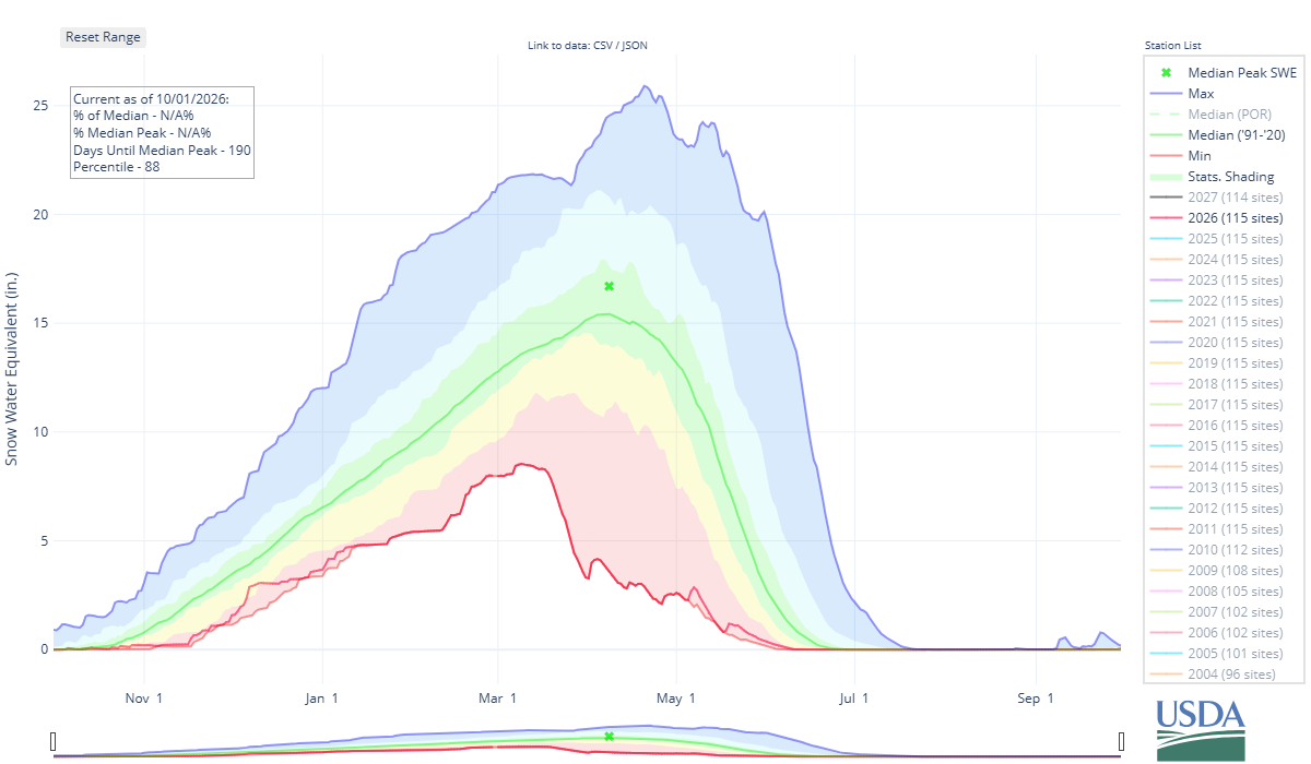
Those statewide indicators tell an important part of the story, but they do not capture all of what happened across Colorado's mountain watersheds. CASM airborne snow surveys provided additional detail during the season, showing where snow remained across individual basins, particularly at higher elevations, even as many lower-elevation SNOTEL stations experienced early melt-out. Basin-wide measurements helped water providers understand how much snow remained, where it was located, and what it could mean for runoff during a difficult forecasting and operations year.
Read below for a look back at the 2026 season, new federal funding for CASM partners, development of the CASM Technical Advisory Committee, and planning for the 2027 flight season.
In this update
2026 Season in Review – What ASO measurements showed during a record-low snow year
$2.23M in New Federal Funding – Three CASM stakeholder projects selected for USBR funding
CASM Technical Advisory Committee – Developing a technical framework for Colorado snow measurement and forecasting
2027 Flight Planning – Preparing for next year's airborne snow surveys
Continued Support and Collaboration – Building Colorado's long-term snow measurement record
Highlights
Water Year 2026 brought exceptionally low snowpack and an early start to snowmelt across Colorado. Warm, dry conditions caused many SNOTEL sites to lose their snow earlier than usual. CASM's mid-March airborne surveys confirmed the widespread snow deficit, but also provided important context that could not be seen from individual monitoring stations alone.
In several basins, lower elevations had little remaining snow while substantial snowpack persisted at higher elevations, in some locations at volumes closer to those measured in 2025. This distinction matters because SNOTEL stations measure conditions at individual points, while ASO measures snow depth across the full watershed. That basin-wide perspective allowed water managers to better understand both the magnitude and spatial distribution of the remaining water stored in snow.
The graphics below compare snow conditions in early March and late April. They illustrate why the timing and location of remaining snow matter. A SNOTEL station can melt out while substantial snow persists elsewhere in its basin, particularly at higher elevations. ASO measurements, combined with continuous iSnobal modeling, help track that remaining snow and estimate the total volume of water stored across the watershed. This basin-scale measurement is one of the core advantages of ASO relative to relying on individual monitoring stations alone. This same distinction between point measurements and watershed-scale ASO observations has been a central rationale for CASM partner projects.
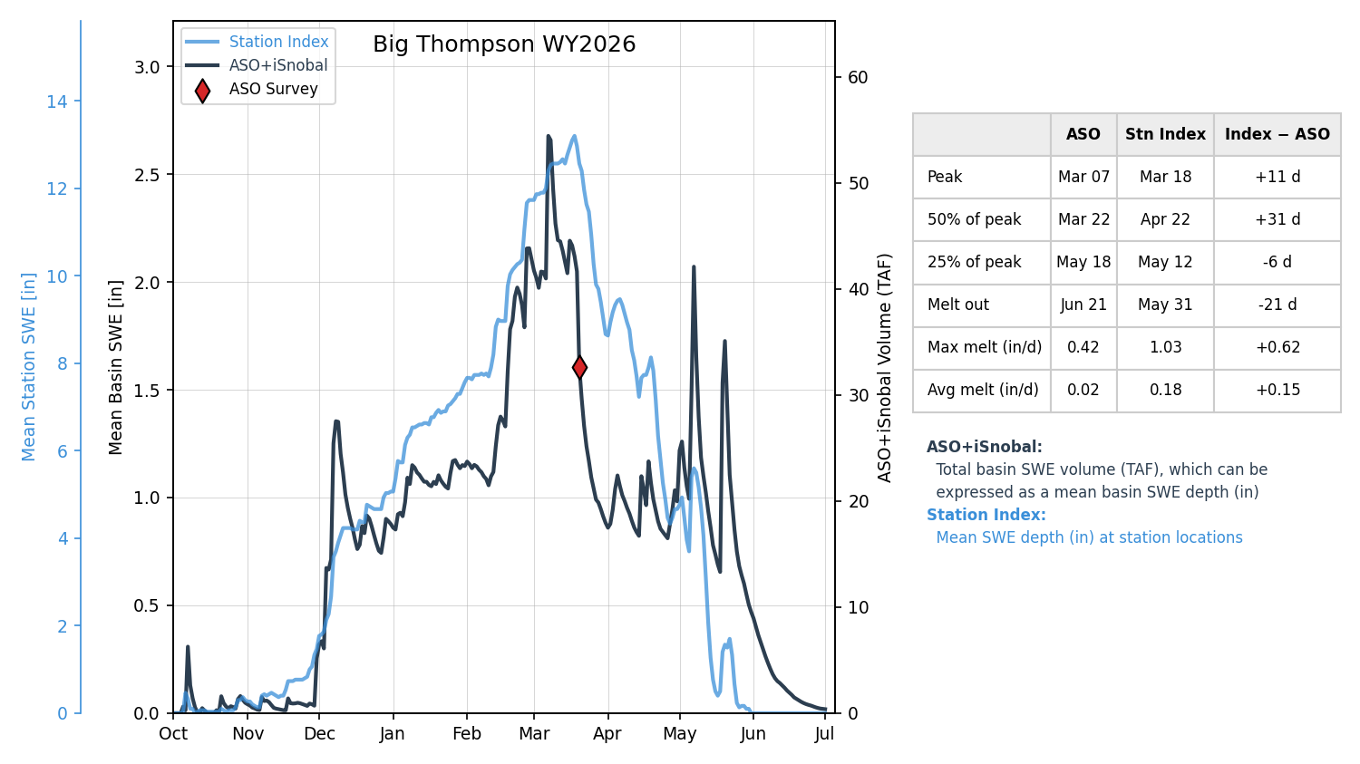
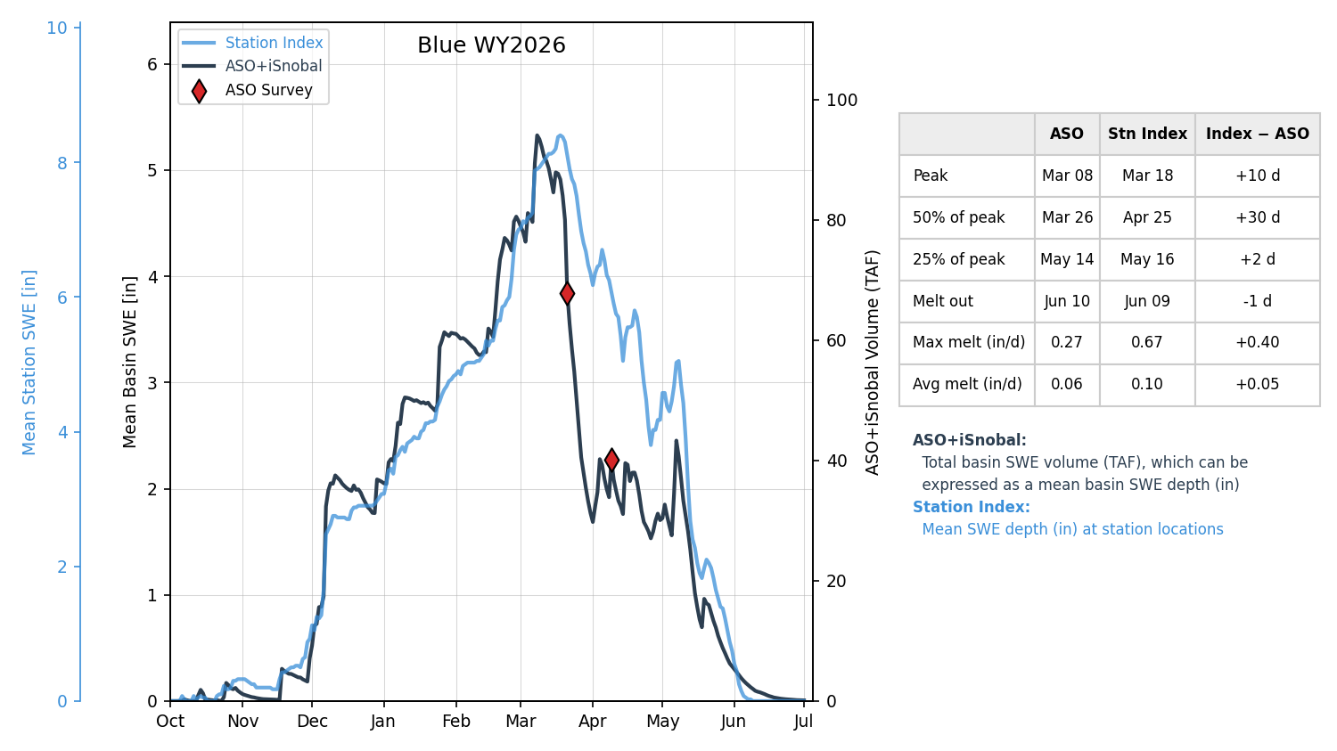
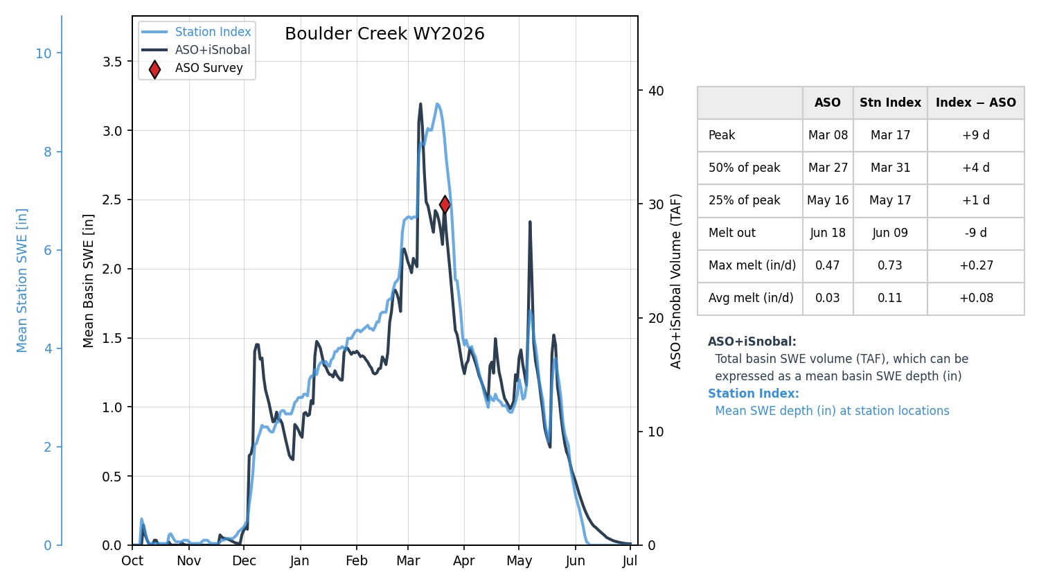
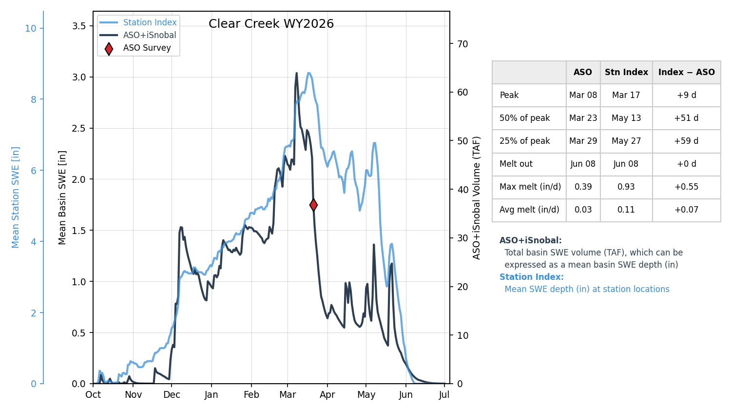
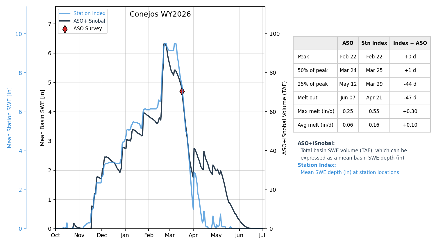
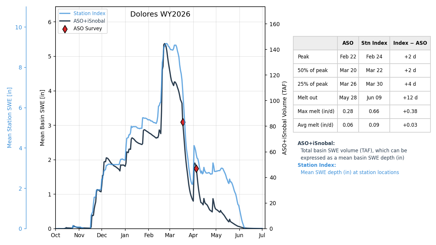
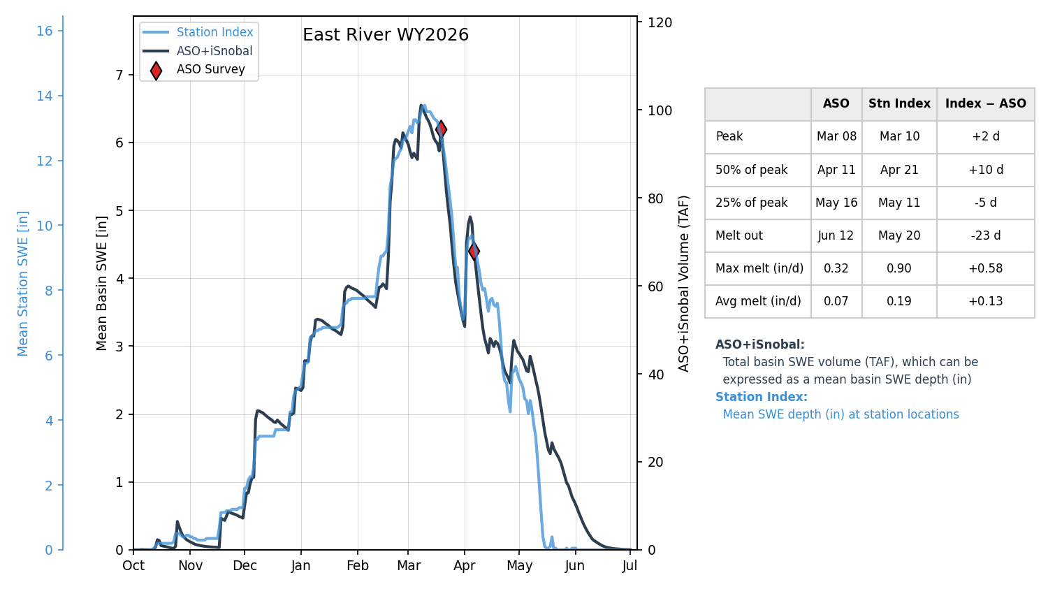
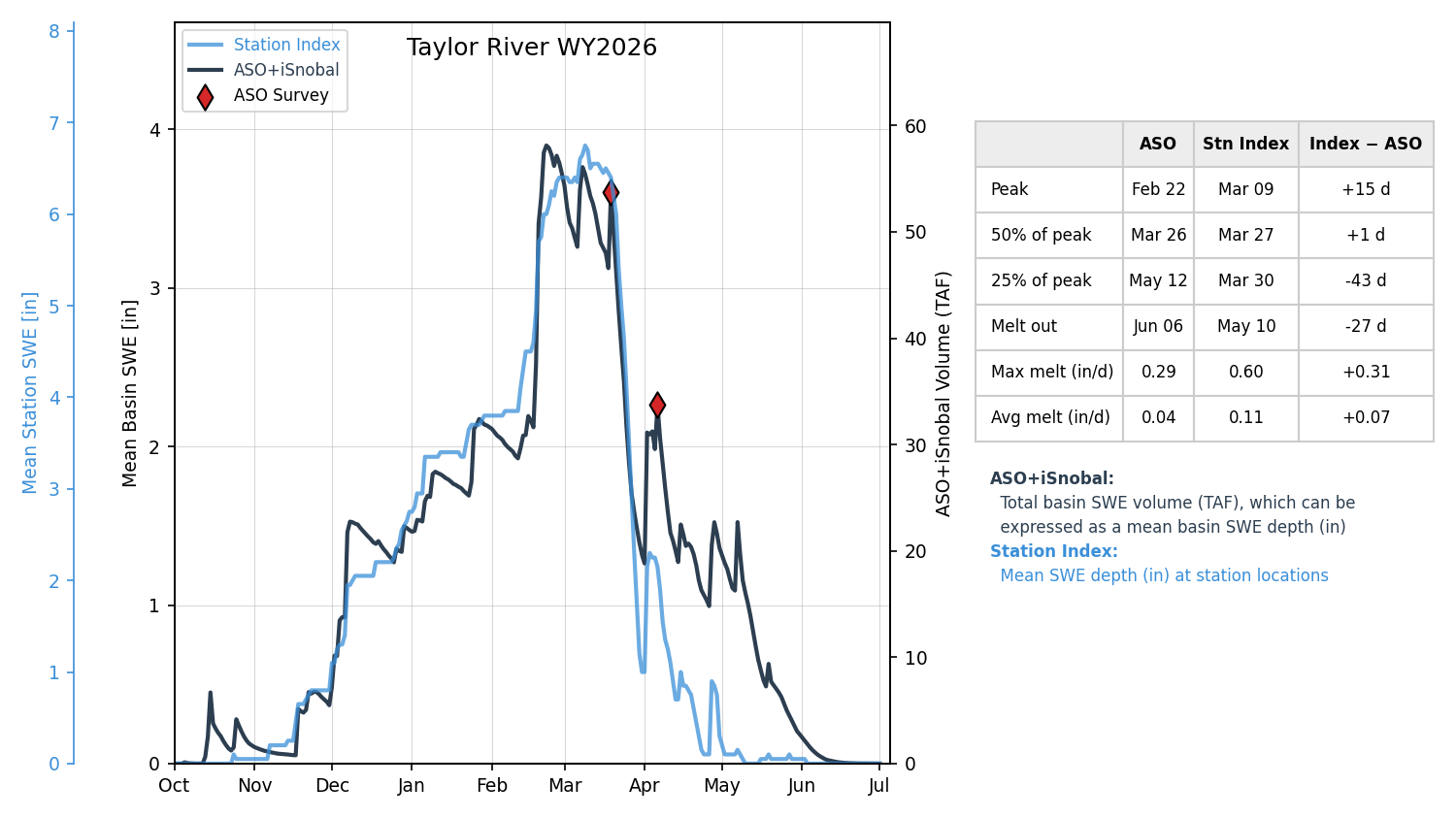
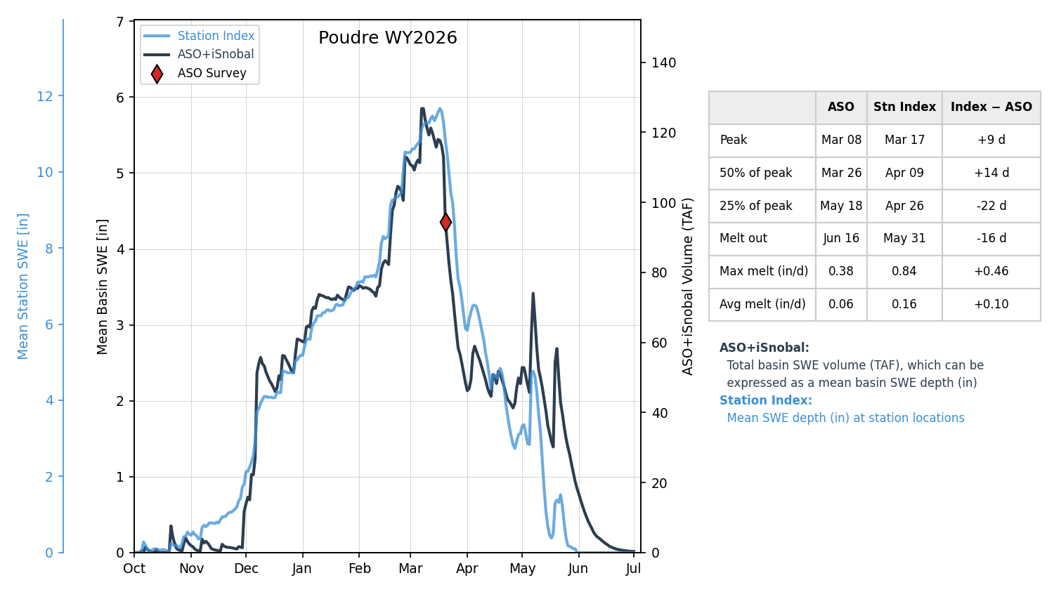
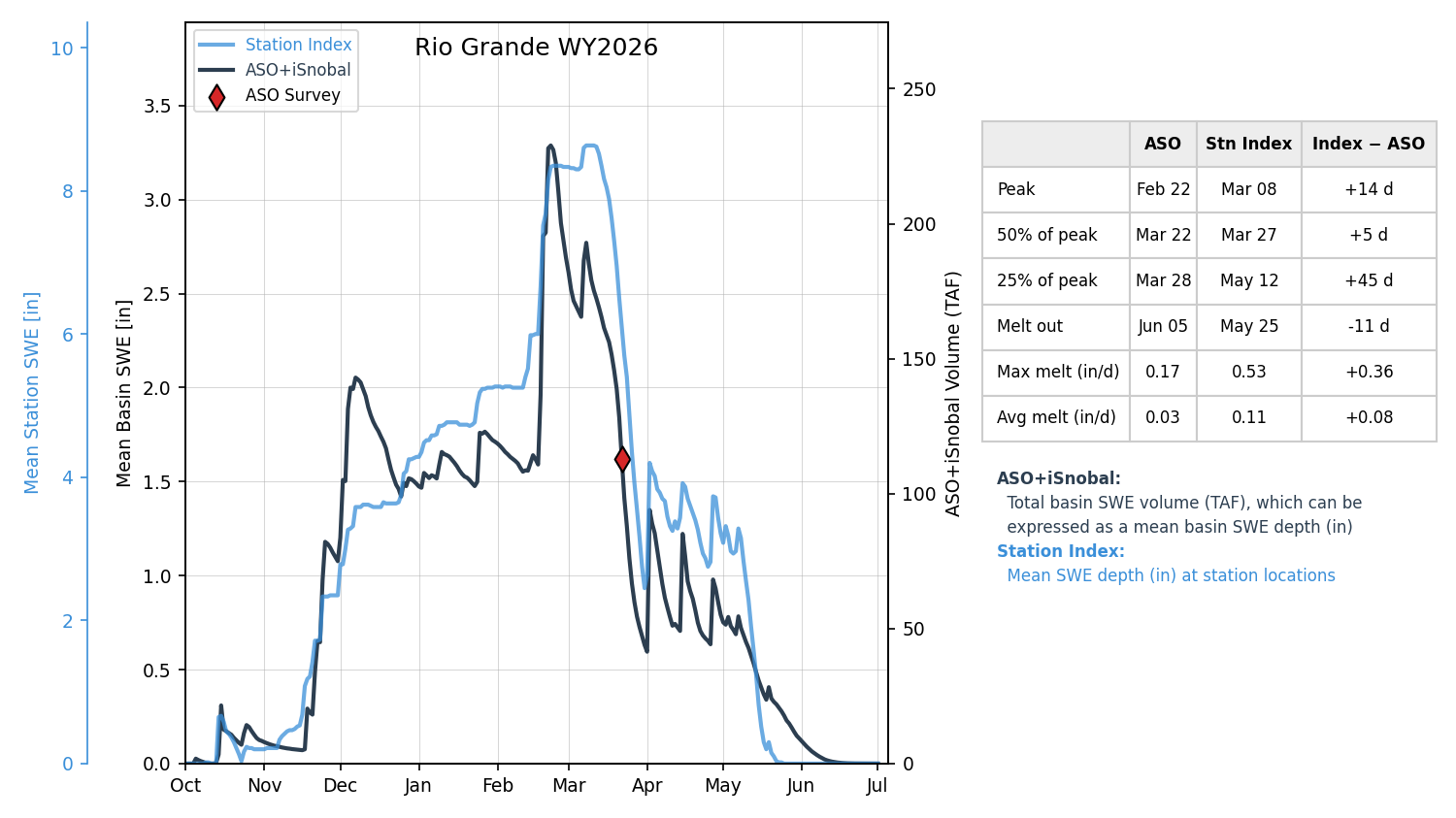
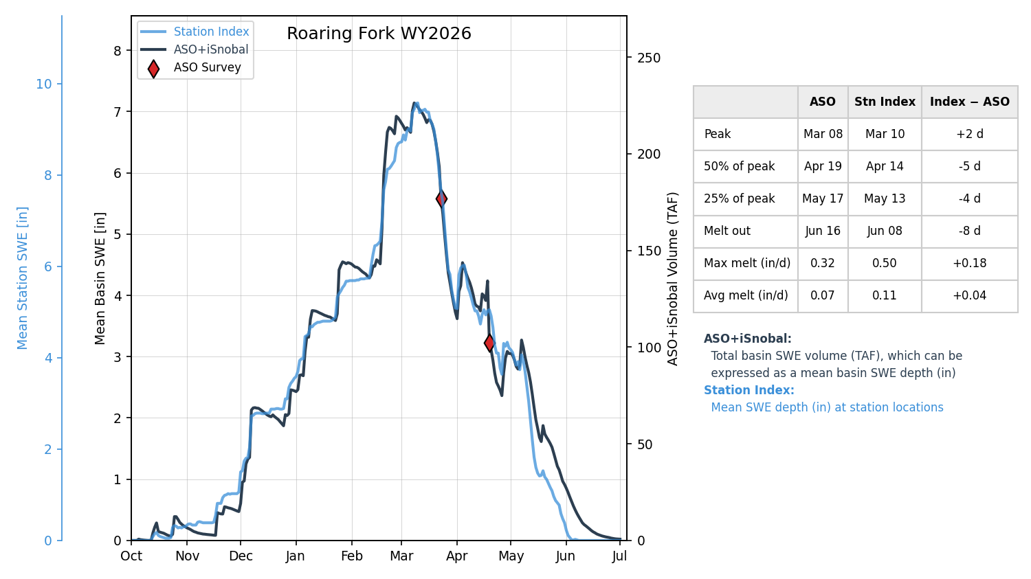
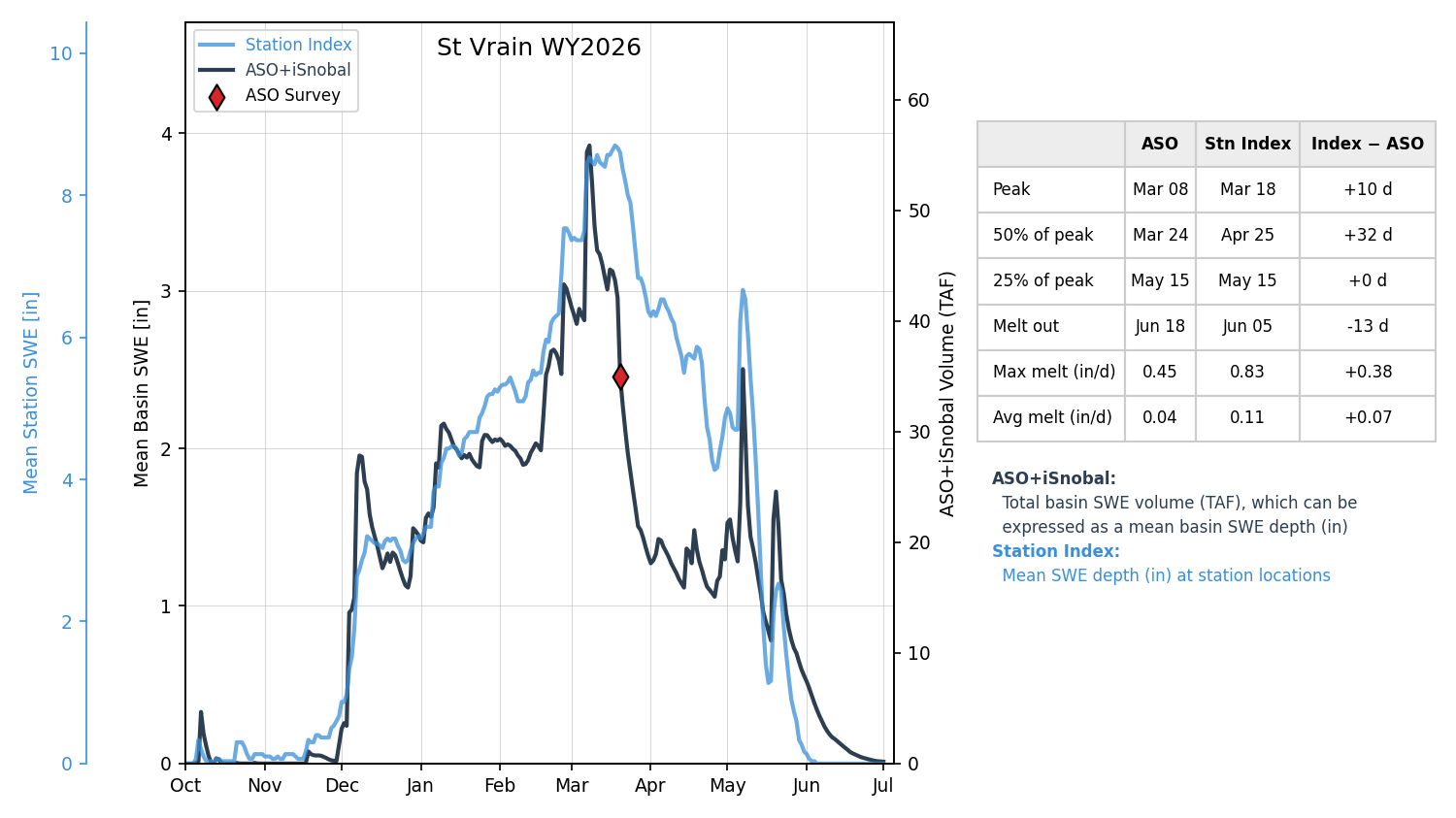
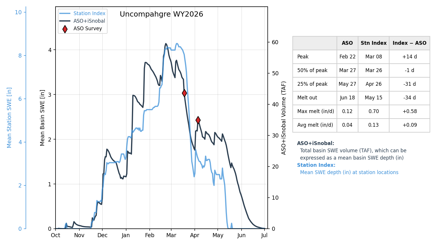
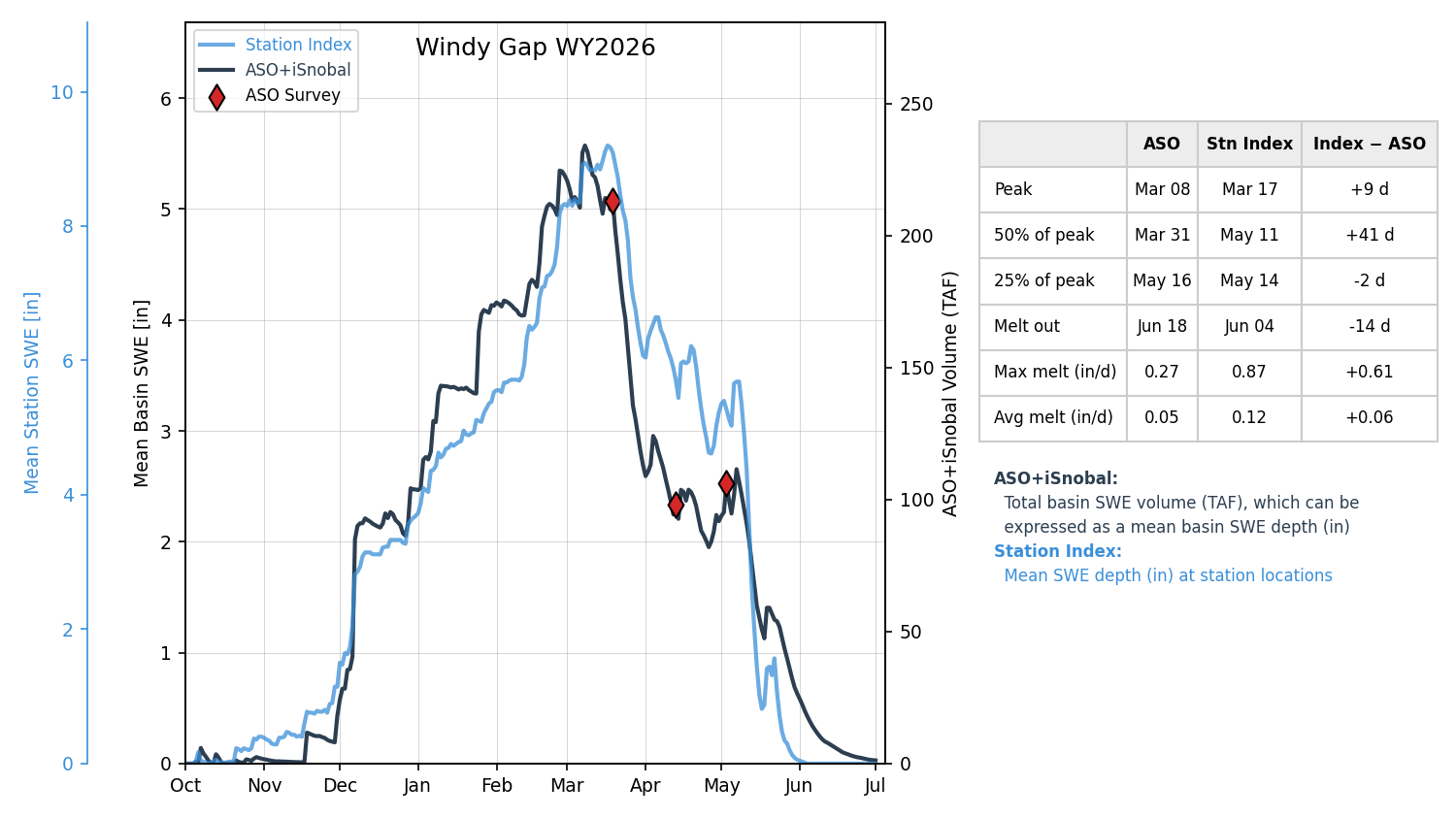
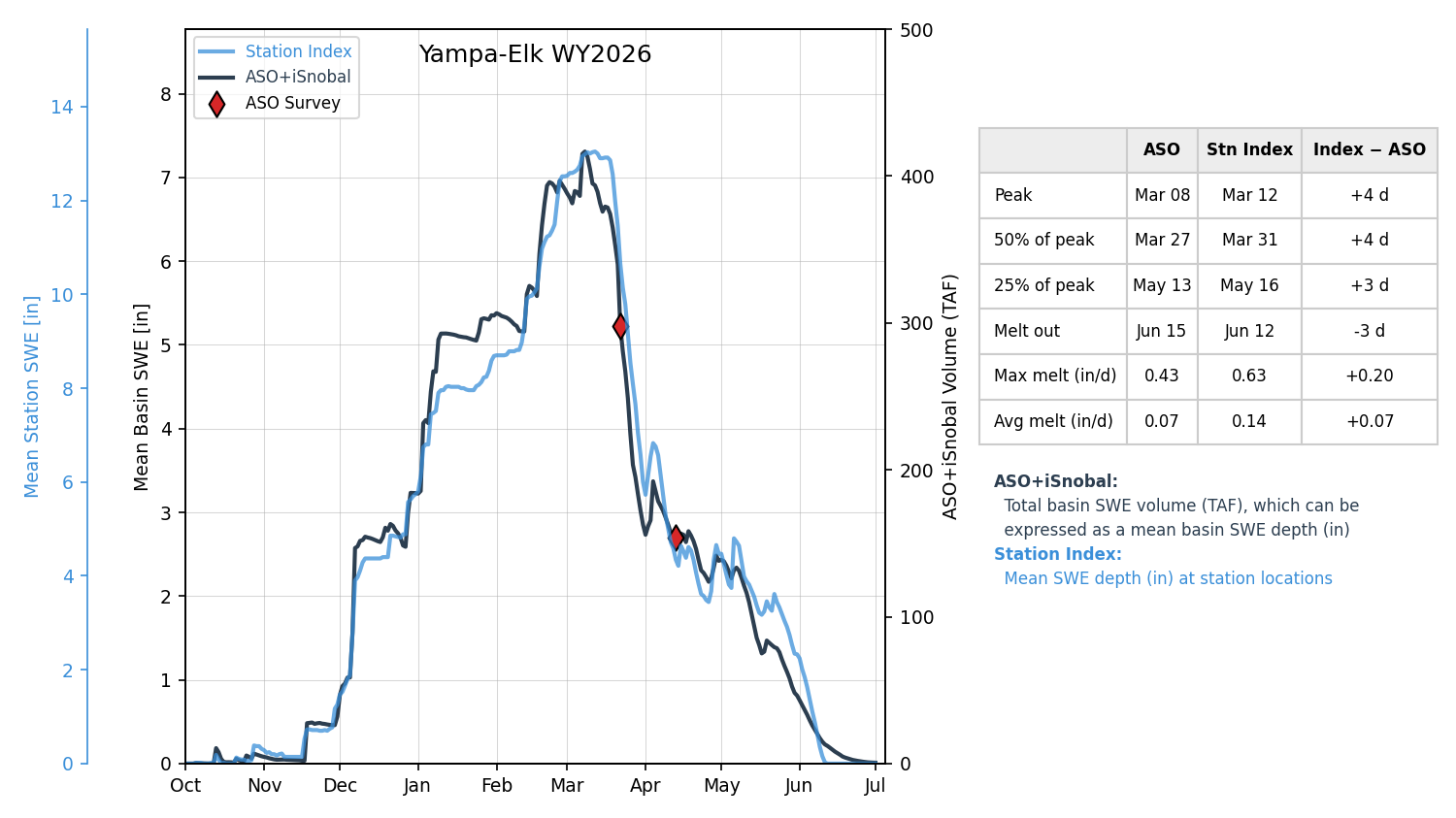
Note the differences between the station-index lines and the ASO + iSnobal lines in the figures above. SNOTEL indices summarize measurements from a network of individual stations. Those stations provide an essential long-term record, but each measures conditions at a single location. Snow accumulation and melt can vary substantially across a watershed with elevation, aspect, vegetation, and other factors.
ASO provides a complementary view by measuring snow depth across the full watershed. Combined with snowpack modeling, these measurements provide an estimate of the total volume and distribution of water stored in snow. During an unusual year like 2026, that additional spatial information helped identify conditions that were not always apparent from the station network alone. The ASO workflow combines watershed-scale measurements with distributed snowpack modeling specifically to characterize these spatial differences.
Funding Opportunities
USBR SNOFO awards were announced on September 1, 2026. CASM stakeholders were awarded federal grants supporting three ASO snowpack data collection and forecast integration projects in Colorado. In total, these grants will bring in $2.23M in Federal funding over the next three years by leveraging $1.48M in matching funds from the State of Colorado and $869K in money from partner agencies.
Northern Colorado Water Conservancy District (Northern Water) – Advanced Snow Data and Forecast Integration in the Colorado Headwaters.
Northern Water’s project entails three ASO surveys each year from 2027 through 2029 of the Colorado River headwaters above Windy Gap: one in mid to late March, one in mid-April, and one in May or early June. The project will integrate ASO snow data and WRF-Hydro forecasts into Northern Water’s forecasting and operations tools, develop a decision-support dashboard, and evaluate effects on forecast accuracy and decisions such as Colorado-Big Thompson quota setting and reservoir operations.
Dolores Water Conservancy District – Forecast Integration and Decision Support for Multi-Objective Water Management in the Dolores Basin.
The District’s project entails two ASO surveys each year from 2027 through 2029 in the Dolores River headwaters, generally in mid to late March and again in April or May. The project will use the snow measurements to improve WRF-Hydro runoff forecasts, incorporate those forecasts into its reservoir operations tools, and assess forecast performance and operational outcomes each year.
Aurora Water (In Partnership with Denver Water) – Advancing Watershed-Scale Airborne Snowpack Measurement and Streamflow Forecasting in Colorado’s Upper South Platte and Blue River Basins.
Aurora Water’s project, in partnership with Denver Water and the Colorado Water Conservation Board, entails four ASO surveys annually in 2027 and 2028: two in the Upper Blue River and two in the Upper South Platte. In each basin, one survey will occur near peak snowpack, typically in April, and another during snowmelt, typically in mid-May or early June. The partners will integrate the data into streamflow forecasts and operational models, compare forecasting approaches, and evaluate how the information affects water management decisions.
Technical Advisory Committee
CASM is forming a Technical Advisory Committee (TAC) to provide scientific and technical guidance on snow measurement and water supply forecasting in Colorado. The TAC will evaluate emerging technologies, models, and research; identify data gaps that matter to water managers; and recommend projects and methods to CASM’s Planning Team. It will also provide a point of contact for researchers and technology developers seeking to collaborate with CASM and share its findings with stakeholders. CASM Planning Team members are selecting representatives from water management, applied science, government, and research. More information about the committee, initial goals and its members will be shared after appointments are complete.
2027 Flight Planning
The CASM team is actively planning the 2027 flight season! The map below shows the proposed areas for snow-on surveys. All finalized areas will be published on the CASM website.
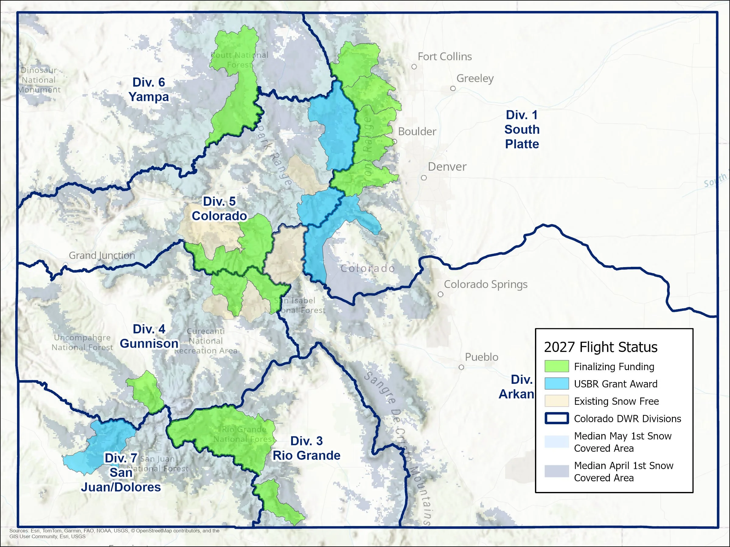
2027 CASM Airborne Snow Survey Planning
Continued Support and Collaboration
As the record of ASO observations continues to grow, the resulting dataset offers an unprecedented view into how snow accumulates and melts across wet and dry years. This information is already transforming how Colorado water managers forecast runoff and make operational decisions.
As a reminder, all past CASM stakeholder meetings are recorded and can be found on CASM’s YouTube channel: https://www.youtube.com/@coloradosnow
Thank you for your continued engagement and commitment to improving Colorado’s snow and water data infrastructure.
Best regards,
The CASM Planning Team