Data Products
ASO Snow Survey Data and associated data products will be posted here as they are released. Data is also available through the ASO Inc Data Portal here: https://data.airbornesnowobservatories.com/ (Free Login Required)
Data Products Include:
Snow Survey Data Reports (ASO Inc.)
Snowpack Model Data (M3Works)
WRF-Hydro Streamflow Forecasts (ASO Inc.)
All available snow survey and streamflow forecast reports are linked in the table below (All data back to 2021, sorted newest to oldest):
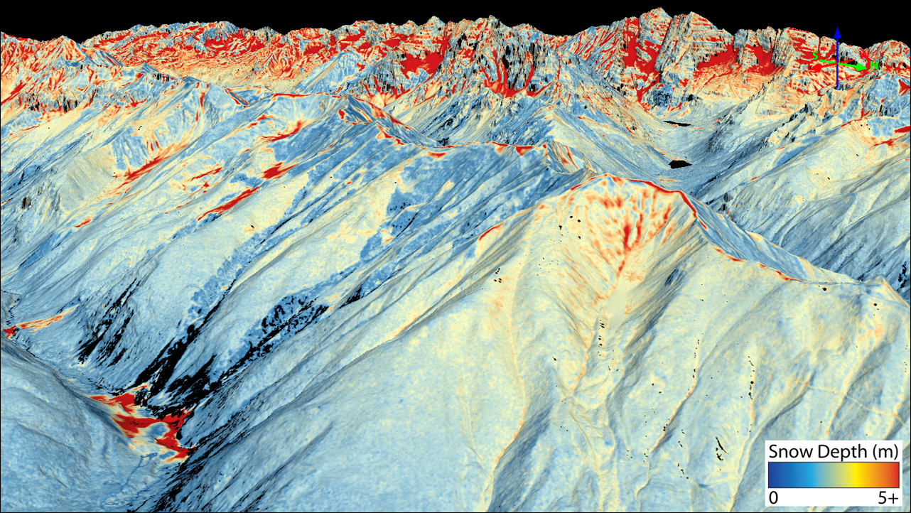
2025 Snowpack Lidar Measurements and Data Products
Map of proposed 2025 activities:

The following basins will be surveyed (number of flights pending):
Blue River and Portion of the Upper South Platte
Conejos
Dolores at Dolores
East and Taylor
Front Range - Saint Vrain
North Fork Gunnison
San Juan Headwaters
Upper Colorado at Windy Gap
Upper Rio Grande
Upper Roaring Fork
Yampa/Elk
What is CASM? What is ASO? Read the FAQ here
The CASM Program plan and FAQ were completed in 2022 and are available for download under Documents > CASM Documents.
All data for 2022-2025 snow surveys and modeling outputs are available under Project Updates.
Since 2020, the Colorado Airborne Snowpack Monitoring Program (CASM), has worked closely with agencies across the state to develop a plan to fund Airborne Snow Observatory flights across Colorado, now and in the future.