Bringing the Airborne Snow Observatories to Colorado

The National Center for Atmospheric Research (NCAR) is producing seasonal streamflow forecasts using its WRF-Hydro model for all basins with ASO flights. Here are the latest forecasts.

6/28/2023 WRF-Hydro ASO-Informed Streamflow Forecast (Updated PDF)

6/16/2023 WRF-Hydro ASO-Informed Streamflow Forecast (Updated PDF)

6/8/2023 WRF-Hydro ASO-Informed Streamflow Forecast (Updated PDF)

6/1/2023 WRF-Hydro ASO-Informed Streamflow Forecast (PDF)

5/22/2023 WRF-Hydro ASO-Informed Streamflow Forecast (PDF)

5/11/2023 WRF-Hydro ASO-Informed Streamflow Forecast (PDF)

The Colorado Basin River Forecast Center (CBRFC) is producing experimental streamflow forecasts that incorporate ASO data as well:

5/25/2023 CBRFC Seasonal Forecasts (PDF links below)

Dolores, East, Taylor, Granby Inflow, Fraser River, Ruedi Reservoir , Roaring Fork at Glenwood, Willow Creek Reservoir, Dillon Reservoir

Browse a map of the latest snow depth (3m) and snow-water equivalent (50m) measurements here:

Webmap Link

Since 2020, the Colorado Airborne Snowpack Monitoring Program (CASM), has worked closely with agencies across the state to develop a plan to fund Airborne Snow Observatory flights across Colorado, now and in the future.
In 2023, the CASM Team is looking forward to Snow-On surveys in many new basins, and development of flow forecasting methods using the WRF-Hydro model. Here are our proposed activities for 2023:

2023-03-02 CASM Flight and Forecast Map

ASO snow surveys require that a basin has had a “snow free” lidar flight conducted for the area to provide a geodetic baseline to compare to the snow survey. Snow-free data preparation is centered around development of an error-corrected LiDAR dataset that has sufficient point density throughout the basin. Existing LiDAR data is typically not high enough quality, or with sufficient point density, to serve as an effective baseline, so individual summertime LiDAR flights must be conducted to collect this snow free data.

CASM’s 2022 Snow Free data acquisitions and remaining target watersheds identified for the project are show in the following map:

The CASM Program plan and FAQ were completed in 2022 and are available for download under Documents > CASM Documents.

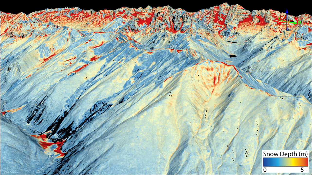
In a 2019 pilot flight series in the Blue River watershed with Denver Water—during a time when the SNOTEL stations in the watershed had melted out—ASO data provided an accurate volume estimate of 115,000AF of water remaining in the high elevations (Figure 3). This provided Denver Water’s operations manager the information needed to accurately reduce Dillon Reservoir levels to account for the incoming runoff, which in turn allowed downstream reservoir operators and other Colorado River reservoir operators to re-time outflows and cancel Coordinated Reservoir Operations (CROS) that could have otherwise led to downstream flooding and lost water supply.

Expanding ASO data collection to cover municipal source water basins on both sides of the continental divide, and throughout the state (see map), would apply a proven value-added method to maximizing use of water supplies. Having accurate knowledge of the volume of the water stored in the snowpack in these headwaters provides water managers the information needed to remove much of the “guesswork” from operations decisions. This allows reservoir storage to be maximized, optimizes flood control preparations, and provides environmental and recreation managers and agricultural producers more accurate information on the quantity and timing of water that will be sent downstream. It will also allow operations managers to make more informed decisions regarding their management of transbasin diversions. The provision of detailed and accurate ASO snowpack data in the years to come will form the foundation for a future that optimizes the use of native supplies for the benefit of multiple parties throughout the state. Further, these data will be invaluable in the planning and operation of future water infrastructure projects.